Few places have inspired me over the years as have the majestic Himalayas. I first traveled there in 2000 when I went to Nepal and trekked for four weeks, including Gokyo Ri to Everest Base Camp and part of the Annapurna Circuit. I had been looking to go back ever since and in August 2015, I finally had the chance. Ladakh is a region in the Indian state of Jammu and Kashmir, which is wedged in between the eastern Karakoram of Pakistan to the east and the mighty giants of the Himalaya in Nepal and Tibet to the west. It’s a land not often visited by those traveling to India, many of whom prefer to head to the other attractions that country has to offer. Few mountaineers also travel there, often preferring to head to the more famous K2, Everest and other regions that surround it. As a result, Ladakh is a paradise for those looking to trek, climb and explore without the crowds.
The opportunity to climb in a region where there are numerous unclimbed 6000 and 7000 meter peaks is what ultimately took me there. The peak I aimed to climb, Nun, at 7135 meters or 23,409 feet is not one of them, but does not often attract expeditions. The peak season to climb in the Ladakh and Kashmir region is July-September and we were only one of 3 expeditions planned for that season. The West Ridge of Nun represented a logical next challenge for me in the mountains since it would take me above 7000 meters for the first time and give me a chance to climb a longer route and slightly more technical route that what I’ve typically done in the past.
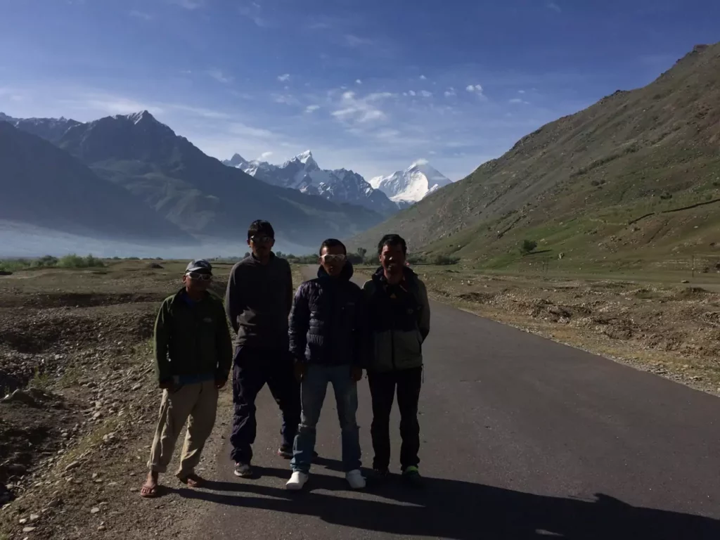
Our support crew on the way to the Nun-Kun Massif. Nun (7,135m) is on the right (Photo credit: Luke Smithwick)
Typically, I like to self-organize and lead expeditions with groups of friends, but opted to join a group that had organized a four week expedition to the region. The convenience of having a group already set to go was fantastic, particularly since it was a last minute trip for me. I had been planning a climbing trip to the Himalaya for quite some time, but when I decided to leave my job in July, I had the perfect window to do it. I decided to join a trip led by Himalaya Alpine Guides, namely, Luke Smithwick, who splits his time living in Leh and Kathmandu and is a veteran at organizing trips in the region.
The group of 7 of us– 4 Americans (Luke, Peter, Evan and me) and 3 Australians (Shiraz, Francis and Anthony)– commenced our expedition in Leh, the small, but bustling main town in Ladakh. Leh would serve as the perfect base for acclimatizing (being at 3,524 meters or 11,562 feet) and for re-fueling and resting in between parts of the expedition. The flight from Boston to Leh (through Newark and Delhi) was long one and the first few days in Leh served as a perfect time to recover from that and get the legs moving at altitude. We hiked up the steep climb to the Leh Palace, built by the Ladakhi King Sennghe Namgyal in the 17th century. Modeled after the famous Potala Palace in Lahsa, Tibet, the Leh Palace dominates the landscape of Leh and provides for a great overlook of the town. We also visited the many monasteries in and around Leh, including Thikse Monastery, where we got to experience a sunrise puja, or Buddhist religious service, that included monks chanting and playing traditional instruments.
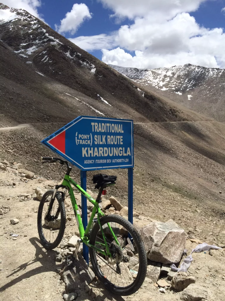
Biking the 7000 foot descent from the Khardungla Pass
One of the highlights of the first few days was a 7,000 foot mountain bike ride descent from the top of Khardungla Pass at 5,359 meters or 17,582 feet (many claim it’s 5,602 meters or 18,379 feet) and back down to Leh. The goal was to acclimatize by ascending the pass, but we quickly forgot about that part as we hurled down the windy, narrow road, passing and getting passed by the daredevil drivers that the people of Ladakh are. It was all worth it, however, since you do not have the opportunity to descend 7000 feet at great speeds that often.
By the end of the first week, we were ready to kick-off our expedition with our first objective: climbs up two 6000 meter peaks, Golep Kangri (5,980 meter or 19,620 feet) and Stok Kangri (6,153 meters or 20,182 feet). We’d take about a week to trek in, climb these peaks and trek out. We hoped to use these peaks to acclimatize for the higher Nun. The first day started in Shang Phu (about 12,000 feet), taking us past some of the most breath-taking views of the Ladakhi
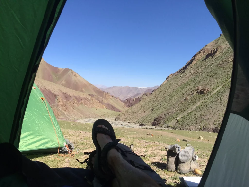
Camping at Mathu Phu
Himalaya. The first day’s camp at Mathu Phu (4,240 meters or 13,864 feet) provided for a relaxing and stunning view of the valley we just climbed.
Ladakh is known for it’s intense sun and dry dust, which we got plenty of along the way. Despite being so high in altitude, day time temperatures often soared to over 75 degrees and felt much warmer. We wore buffs to keep the dust out of our respiratory system, which could lead to the infamous “mountain cough” later in the trip. Applying loads of sunscreen and lip balm were part of our daily routine, as was using anti-bacterial cleanser before eating. Staying healthy was a top priority and we needed to tend to the details.
Climbing over a couple of passes, including one at 5000 meters or 16,404 feet, we arrived at Stok Kangri Base Camp (4,983 meters or 16,350 feet), which was a collection of tents from climbers of many different nationalities, surrounded by 20,000 foot peaks. Stok BC would serve as our home for the next few days as we practiced necessary mountaineering skills for Nun (fixed rope climbing, etc.) and climbed Golep Kangri and Stok Kangri.
At the summit of Golep Kangri (19,620 feet)
Golep Kangri is a less often climbed peak and a great challenge unto itself. The first part of the ascent from base camp took us up a nice ridge line and finished in a scree field before we geared up to climb on the glacier. We reached the glacier in the late morning and started climbing in the heat of the day, paying the price with soft snow and the threat of lightening that often blows in later in the afternoon. The roped climb to the summit finished with a challenging 60 degree slope, which we climbed on belay, then made the final push to the summit. By the time we reached the summit, we were all fairly tired and decided to descend after enjoying the hard-earned, breath-taking views from the top. That’s when the fun began.
A lightening storm rolled in just as we were rappeling down from the summit. I fortunately had made it to the bottom of the rope and managed to get off belay when a loud clap of lightening sounded over the summit, where the rest of the team was. No one was hurt, but later on everyone reported that they could feel the hair on the back of their neck standing up and their ice axes vibrating with energy as they were on the summit. We were fortunate to escape without a lightening strike.
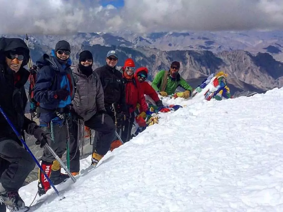
At the summit of Stok Kangri (20,187 feet) (Photo credit: Anthony Buckingham)
After a rest day in between, we set off to climb Stok Kangri at 2AM. While it’s not fun waking up in the middle night when it’s dark and cold to gear up and climb, it allows for much more stable snow and weather conditions and overall safer and more enjoyable climb. Moving by headlamp, we reached the glacier after a few hours and just in time to see a spectacular sunrise over the summits around Stok, including Golep Kangri. We zig-zagged our way up a 45 degree face of Stok (which from a distance looked much more intimidating than it was), and eventually reached the final ridgeline to the summit. We kept the ropes tight since the ridge was quite exposed. In fact, an Israeli climber had sadly died on this exact ridge just a week prior. We had spectacular conditions as we snaked our way to the summit, with the whole team making it to the top in celebratory fashion.
We made it back to Stok Kangri base camp by mid-afternoon and were greeted by our reliable and fantastic support crew. Not enough can be said for how well organized and hard-working these folks are. They come from the native populations of Ladakh and also from surrounding regions and countries, such as Nepal. Our cook prepared a good variety of meals to sustain us at altitude, mainly made up of Indian dishes and traditional rice and lentil beans (dahl bat), which is the staple of the region. While I typically don’t eat rice and beans (or any grains), I waived my usual dietary restrictions for convenience and just to be able to consume enough calories to keep myself going in the mountains (and to experience the full cuisine of the region). Loss of appetite due to effects of altitude was a major monkey wrench in past expeditions I’ve been on and I wanted to make sure I avoided lack of caloric in-take being a reason for not being successful this time.
The trek out of Stok Kangri brought through a spectacular canyon, where we were surrounded by towering rock faces that glistened in the sun and echoed with the sound of a raging river we walked next to. Our vans greeted us in Stok village and we made the journey back to Leh to re-group for the push up Nun.
While in Leh, we were able to shower and sleep in a real bed after not being able to for a week– always a nice treat. We quickly surrendured these luxuries and set off for Kargil, where we would begin the expedition up Nun. Kargil is in the heart of the Muslim section of Jammu and Kashmir (Leh is in the Buddhist section) and only a few short miles away from the Line of Control (LOC), which is the cease-fire line agreed upon between India and Pakistan in 1972. Kargil was the epicenter of a conflict and nearly all-out war between the two countries back in the 1999 and has always been a focal point of Pakistan’s claims to Kashmir. The history of conflict between Pakistan and India is a long and complicated one, with Kashmir at the heart of it. Both sides have nearly a million troops on both sides of the LOC. While we saw lots of military activity (mainly trucks being shuttled back and forth), not once did we feel unsafe our entire time in Jammu and Kashmir. In fact, it was quite the opposite whereby we could walk the streets of places like Kargil and on the glaciers of mountains that straddle the two countries with no problems. The biggest inconvenience we faced were the numerous permits required to travel in the region and endless (and mindless) passport checkpoints we had to go through.
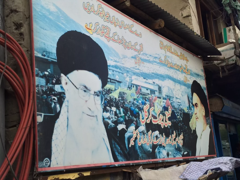
Billboard of the ayatollah Khamanei and ayatollah Khomeini
Kargil proved to be an interesting town (despite being a dry town), with many markets and winding streets. The cuisine is very similar to that of Ladakh, with a bit more spices and heat. It was my first time in a Muslim-majority area and I found the people just as friendly and open as those in Buddhist Leh. Most of the Muslims in Kargil and the surrounding area are Shi’a and as a result, have a fondness for the ayatollahs of Iran. As an American it was a bit strange to see billboards with the ayatollah Khomeini and the current ayatollah Khameini on it, but at the same time, very interesting to talk to the locals and understand their reverence.
We set out of Kargil on a dusty road to the village of Tongol, which would be the last village we’d see before the long climb up Nun. We spent the night in a bunkhouse run by a local, who helped coordinate the young and strong boys (and most were boys, perhaps no older than 16 or 17) from Tongol to serve as porters for the expeditions that pass through. The porters, wearing no more than flip-flops in some cases and carrying massive loads that weighed close to 100 pounds, easily climbed up the very steep slopes comprised of clumps of grass and scree rock to Advanced Base Camp (ABC) for Nun (we decided to skip Base Camp given our well-acclimatized state).
ABC was nestled in between several 20,000 foot peaks surrounding the main peaks of the Nun massif– Nun and Kun. We would leave behind the comforts of a mess tent, and single tents (now having to share 3 people to one tent) at ABC, as well as those services of porters, requiring us to carry our large loads up the final stretch of the mountain. Stripping everything down to the bare essentials was key since any extra weight– no matter how small– would slow us up and jeopardize our chances to summit. We were forced to make choices of whether to bring a tooth brush, an extra camera battery and an extra base layer of clothing.
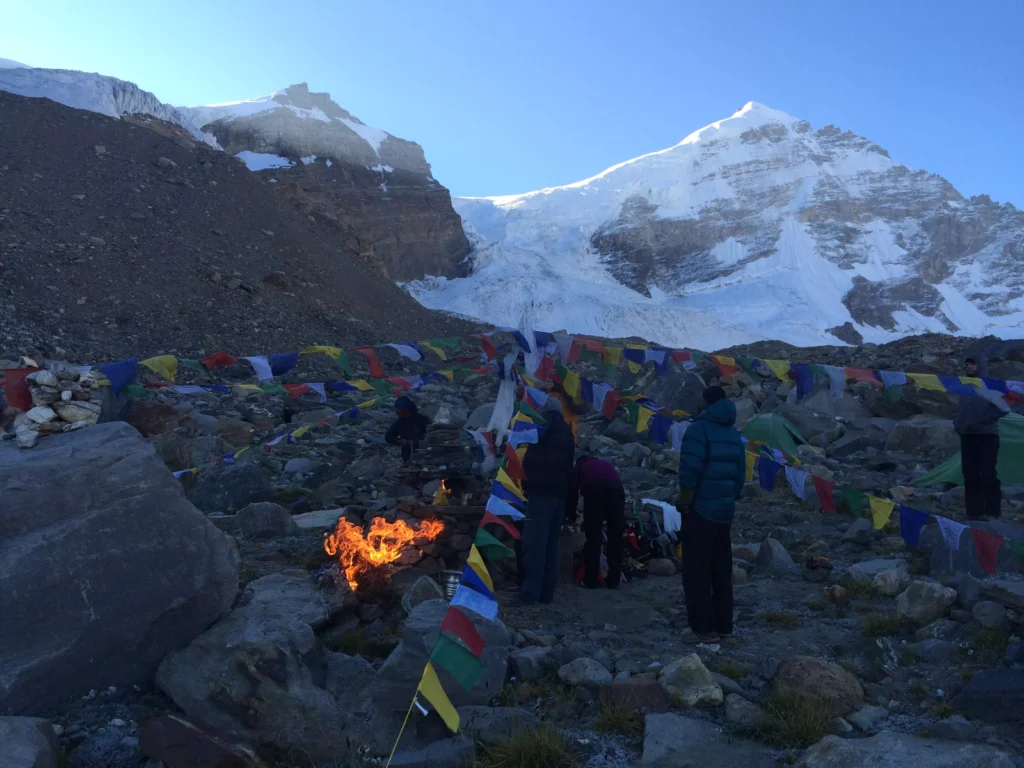
The Sherpas held a puja for us at ABC on the cold and early morning we left to begin our final ascent. It was an interesting ceremony with short prayers, incense, throwing of rice, gifts of food and shots of chhaang, an alcoholic drink brewed from rice by the locals throughout Tibet, Nepal and Ladakh. The ceremony was designed to deliver us luck and success on our climb. We were wrapped in khata, traditional scarfs that represented purity and compassion, and began our climb up the scree field towards the glaciers of Nun.
Puja at Nun Advanced Base Camp
The climb up to Camp One required us to ascend fix ropes a good part of the way, including a more technical section of about 50-55 degree ice where we needed to do more front-pointing and make greater use of the ice ax. It was a very long day, but we finally got to Camp One, which sat on a large snowfield looking up at the summits of Nun and Kun. The temperature was noticeably lower at 5500 meters or 18,044 feet, so we nestled ourselves 3 people to a
Our climbing route up Nun.
tent and settled in for a beautiful and peaceful night in the mountains.
The climb from Camp One to Camp Two was the crux of the West Ridge, requiring us to climb up some rock faces and steeper slopes that approached and at times exceeded, 60 degrees. Our Sherpa support team had fixed the route all the way to the summit, which allowed to climb with greater safety. The stamina required by the Sherpas to fix the line to the summit was absolutely incredible. High altitude mountaineering is difficult enough with a fixed line, but climbing while fixing the line, is truly a Herculean task. Sherpas are among the best athletes on the planet. Put any of the Sherpas who climb on expeditions at sea level in the western world to run a marathon or complete a similar endurance event, and they would easily crush the competition.
The climb to Camp Two (6,050 meters or 19,849 feet) was perhaps the longest of all the day we had, requiring much energy as we climbed higher and higher. Camp Two sat in a sheltered area below some seracs, which were a bit sketchy as they made noises and occasional cracking sounds. We were reminded that the glacier indeed is alive and we needed to be mindful of staying safe even while in camp.
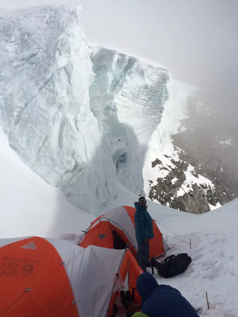
Among the seracs at Camp Two (6,050 meters)
We were at 6,050 feet at Camp Two, which was the first of three nights we would spend above 6,000 meters. At this elevation, the body is literally consuming itself as it struggles to get enough oxygen in to keep vital organs functioning. The body is burning calories just sitting. To complicate matters, Camp Two is where my appetite started to wane. Actually, it was a combination of the effects of altitude and the monotony of the food that we brought with us. It’s not practical to carry a lot of heavy food items and fuel to cook it, so basic beans and rice coupled with an unappetizing assortment of biscuits was what we had to deal with. As a result, I consumed less than optimal. Otherwise, I felt strong– stronger than I ever had at altitude.
The start of the day for our push to Camp Three started off with a few high, ominous clouds. We did not think much of it as we downed some cold cereal and then pushed off. The start of the climb up the 50 degree slopes started off clear, but clouds quickly moved in. After about 2 hours, we were fully encased in clouds and a stiff, cold wind blowing. Visibility was down to nearly zero. Unfortunately, this occurred on a section of the route that was not fixed and we were relying on wands to find the route. We had to re-group the team that had spread out over the course of a quarter mile for safety reasons, and stopped since we had lost the wands and hence, the trail. We couldn’t see what was around us and didn’t want to wander into a crevasse or down a steep slope, so stopping and waiting was our best bet.
The Sherpa team was ahead of us, having forged forward to set up Camp Three. We were hoping they would turn back to come find us, but that did not happen. We stood in the howling wind for over two hours, during which time our Indian liaison officer (who we were required to have with us by the Indian government), caught up with us. He was very fortunate since he was alone and could have easily gotten lost (or worse) in such treacherous conditions.
After about 3 hours of standing and waiting, I reached a point where I needed to get moving or I knew not so good things were in store. I was wearing all my down and my core was warm, but since I had not eaten a lot due to loss of appetite, I did not have sufficient fuel to fuel my extremities and my feet started to get really cold. I wiggled my toes and kept moving my feet, but I knew if we didn’t get moving I would risk frostbite. After some debate, Peter, one of the Americans on the trip, decided to do some route-finding while we had him roped up. Finally, he successfully managed to spot a wand, which we followed. We then caught the next one, then the next one, until we finally saw the tint of orange through the white-out conditions and eventually stumbled into Camp Three (6500 meters or 21,325 feet).
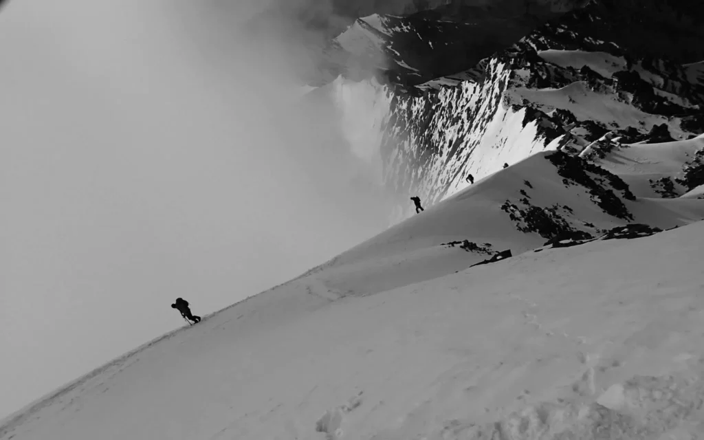
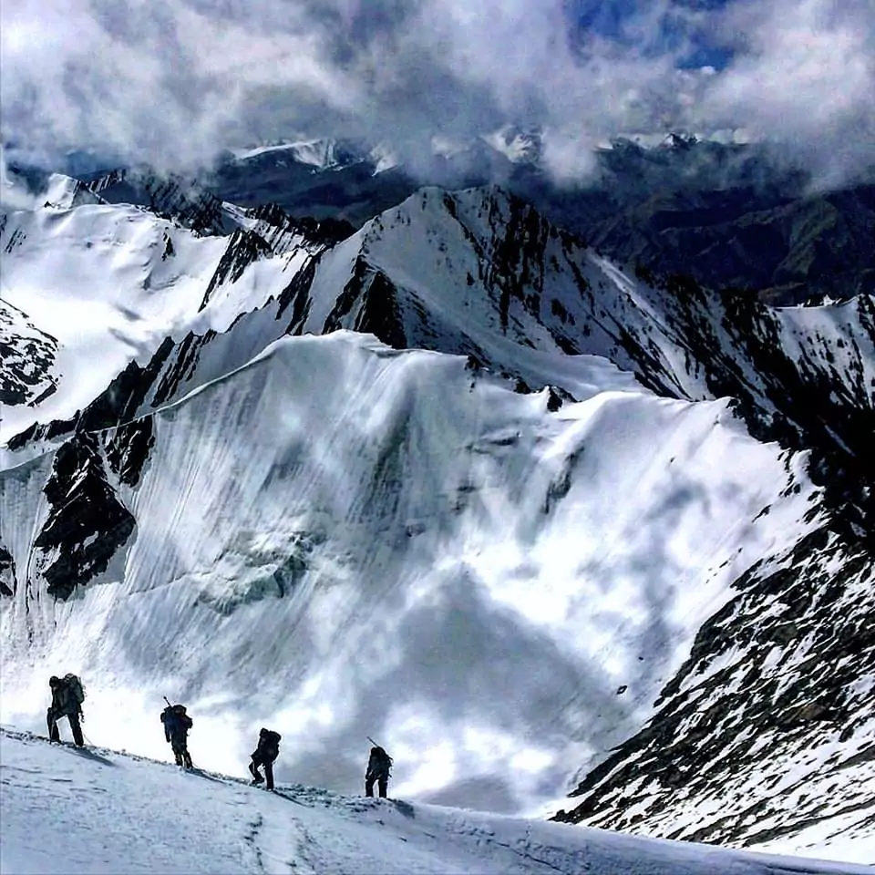
Climbing in the Himalaya of Ladakh (Photo credit: Anthony Buckingham)
I had expended all of my energy at that point and was eager to get fluids and food as well as take my boots off in a warm tent. When I finally did so, I saw that my toes were slightly discolored– a very pale white color. I was a bit surprised and relieved at the same time. I could still feel my toes, although they were slightly numb, particularly the big toe on the right foot. As they warmed up, they began to get a sharp tingling session, which continued for several hours. After much thought and debate, I decided at that point I would not attempt to go to the summit. I knew doing so risked, at a very high probability, of getting severe frost bite. It would have been easy to say, “Screw it, I’ll be okay,” and have gone for the summit. The harder thing was to say, “No, no summit is worth risking losing body parts over”. I know had I gone for the summit, I could have been looking at a situation where I would have gone home with no toes. It simply wasn’t worth it– not with 2 kids at home and for how active I am. Not for anything. The summit attempt was over for me, and I was fine with that. I had made it to 6500 meters– the highest I’ve ever been (or slept)– and done so feeling strong up until this point. I know had we not gotten caught in the white-out for 3+ hours, which turned a 3 hour day into a 6 hour day, I would have not had frost bite concerns and enough energy to get to the summit of Nun. Knowing that and making it to this point, coupled with the successful climbs of Golep Kangri and Stok Kangri, was a success for me.
Nearly 4 months after the trip as I write this, I have no regrets over my decision and know it was the right thing to do. I had numbness in my toes for several weeks following the trip, lost my toenail on my big toe and experience a high level of sensitivity to the cold in my toes– moreso than I did before the trip.
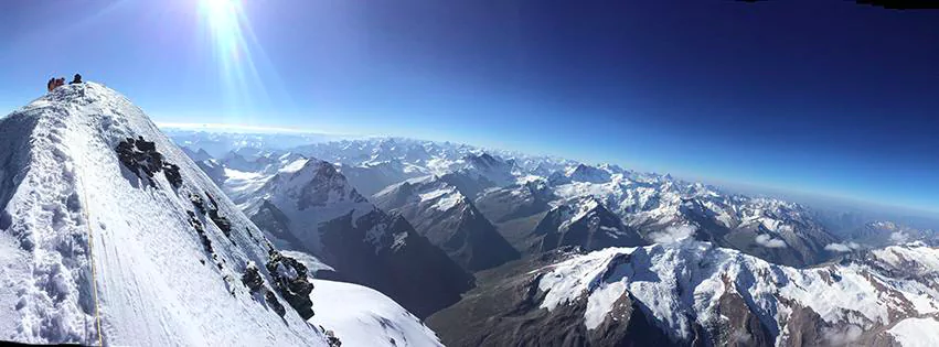
Curvature of the earth as seen from the summit of Nun (7,135 meters or 23,409 ft) (Photo credit: Luke Smithwick)
Half the team decided not to summit and the other half decided to go for it. They had an alpine start at 12 am, and successfully made a 12 hour round-trip climb to the summit of Nun. They had great conditions, albeit very cold temperatures. The view from the top, and indeed, from Camp Three where I remained, were spectacular. It was one of the only times where I could see the curvature of the earth at such a high altitude.
After three nights at 6000+ meters (2 of which were at 6500 meters), I was eager to start descending. We also were very fortunate with the weather (except for the journey from Camp 2 to Camp 3) and we did not want to push our luck much further by spending more time higher up. A secondary attempt at the summit wasn’t possible in any case since we did not have enough food or fuel to spend another day. So we began the descent.
The original plan was to push to Camp One and spend the night there, but it was decided to keep pushing to Advanced Base Camp. That decision made for an extremely long day, which included a descent of 3000+ feet over several miles of glacier and down climbing on rock in the blazing sun of the day. By the time we rolled into ABC, I simply threw down my pack, took off my boots and collapsed in my tent, as did the rest of the team.
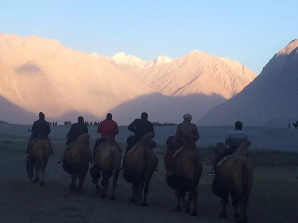
Camels on the dunes of Nubra
We spent the next day in ABC, then hauled ourselves down to the village of Tongol on the next day, where we caught our rides back to Kargil. Getting to Kargil and having real food, a real bed and a real shower worked wonders to bring us back to life. All of us still had several days left before we were to head home, so we made plans to go explore the Zanskar Valley, which is a high desert mountainous region on the flanks for the northern Himalaya.
After an 8 hour car ride from Kargil to Leh,
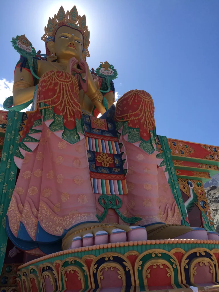
we re-stocked our supplies in Leh, got the necessary permits and headed off to Zanskar. We arrived in Nubra as the sun was setting, and were able to catch camels wandering the surreal 10 mile stretch of desert dunes that surrounded the village and sat in between towering snow-capped peaks. We camped among the dunes and then the next day visited the Diskit Monastery, home to one largest statues of the Maitreya Buddha, before heading out to explore one of the many remote valleys of Zanskar.
We found a beautiful spot about a one hour drive in from the main road in Nubra. It was one of the most peaceful spots we had visited with a quiet, remote village which gets very western visitors. We camped the night, then visited a couple more monasteries before heading back to Leh. We celebrated a successful trip in Leh on our last night together, devouring mass quantities of Indian food at fantastic restaurant we discovered in town.
I had the opportunity to explore Delhi on the way back to the US since I had a day’s layover in the city. The craziness of Delhi was in sharp contrast to the quietness of the past month in Ladakh. The city pulsated with life, overwhelming the senses with its marketplaces, palaces, temples, traffic and sheer number of people. I explored Old Delhi, particularly enjoying the spice market and taking a rickshaw ride through the narrow streets, visiting a J’ain temple and the Jama Masjid, the largest mosque in India, along the way. I also got to experience street food, visit the Rashtrapati Bhavan Presidential Palace and the India Gate memorial for the Unknown Soldier. The day in Delhi gave me a taste for what the rest of India must be like and as I boarded the plane to head home, I vowed I’d return to one day to explore the rest of the sub-continent.
I returned from this trip feeling a strong sense of accomplishment and very relaxed– more relaxed than I have from similar trips I’ve done in the past. The main reasons for that were that I truly had disconnected from the busyness of life and tendency to be “always on” through technology. Having a sporadic internet connection, and no internet connection when climbing and outside of Leh, allowed me to disconnect with technology and reconnect with the outdoors and with humanity. I love technology and the benefits it can bring to society (which is why I work in high tech), but I also hate it since we tend to replace relationships and time spent exploring with dependency on devices. It’s about seeking a balance between being over-connected and over-reliant on technology and benefiting from what technology can add to our lives.
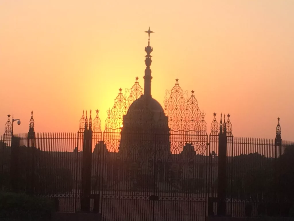
Rashtrapati Bhavan Presidential Palace in Delhi
One could spend a lifetime exploring the Himalaya and not see it all (Photo credit: Anthony Buckingham)
I also think think a big reason for my state of relaxation after this trip was due to the sheer beauty of Ladakh, in terms of both the landscape and the people. My return to Himalaya reminded me of why I love this region so much: the sheer grandness and enormity of the mountains– the highest on earth– and simpleness and friendliness of the people who inhabit the region.
Nowhere else on the planet can you find mountains so high, so majestic and still untouched. The beauty of the Himalayas are soul-touching and life-transforming. One could spend a lifetime trekking and climbing in the mountains of the Himalaya and not see it all. With regions such as the Karakorum of Pakistan, the high plateau of Tibet, the Dolpo and Mustang regions of Nepal, Sikkim in India, Bhutan, and so many other areas, I certainly plan on returning to explore more.
The people of Ladakh are a tapestry of different ethnic and religious backgrounds, all contributing to the uniqueness of the region while living peacefully together. Buddhism flourished throughout the region for centuries and still plays an important role in everyday life and helped to shape the landscape. Islam came later and became the faith of the majority of people in eastern Jammu and Kashmir. Other faiths, such as Christianity, and Hinduism played lesser roles, but also contributed to what
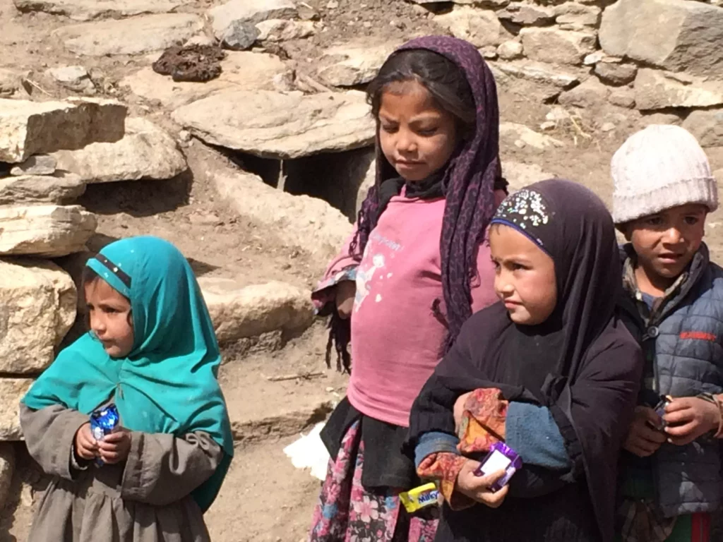
The people of Ladakh are a tapestry of different backgrounds
makes Ladkh unique. The people don’t have immense material wealth, but have great wealth with their connection to their community, their landscape and their spirituality. While suffering certainly exists as it does in every corner of the earth, happiness dominates, whether it be in the open marketplaces, community celebrations or in temples, mosques or monasteries.
As time passes, Ladakh will evolve and change. Technology, climate change, and the impact of modern economic development all will have their impact and transform Ladakh. However, the magic of Ladakh will never go away as long as the mountains and the people remain.
To see more photos of my Nun Expedition, visit: http://tinyurl.com/glov6v4